About
City Parking Guide (Kathodigos) Project
Description
City Parking Guide is an ITS application developed by a R&D consortium of Greek academia, industry and public authorities. It uses wireless sensor networks and web technology in order to monitor, control and manage roadside parking in large cities.
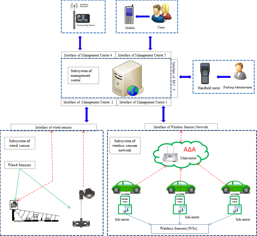
The system uses the capabilities offered by distributed collaborative wireless sensor nodes for detecting free parking spaces along road axes and monitoring their use in frame of a payable or not parking service. Thus the parking administrator can be aware in real time regarding the availability or not of parking spaces in the controlled area and pass this information to drivers looking to park their car. The information can be sent to road screens or it can be accessed through a proper mobile application. The system can guide the driver to a free place, monitor the time that the place is used (paid or managed otherwise) and inform the manager or the driver for time limit violations. The system combines information from wired sensor networks (traffic cameras) correlating the traffic in adjacent roads with the parking demand. System data can substantiate decisions and support the re-engineering of the management of parking spaces in a rational and safe manner locally.
Objectives
The City Parking Guide shall improve the management of road-side parking spaces using state of the art technology and providing real time information regarding parking and traffic situation in congested traffic areas of the city.
The system doesn't aim to solve specific road traffic problems but it will contribute to:
- Provide car drivers information on available short-term parking in congested areas
- Reduce car emissions and relative levels of air pollution
- Save time and driving kilometers, currently wasted looking ineffectively for free park spaces
- Reduce traffic congestion
- Support local authorities to manage road-side parking places and
- Enhance in general the quality of life in large towns.
A pilot scale application of the system has been installed in the city of Athens, for the monitoring and managing controlled parking places in selected areas and monitoring the traffic on adjacent roads leading to them. The pilot system has been demonstrated within the first semester of 2014.
Methodology
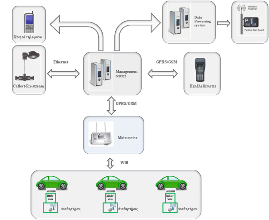
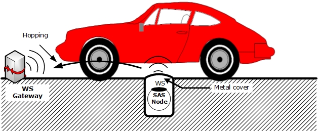
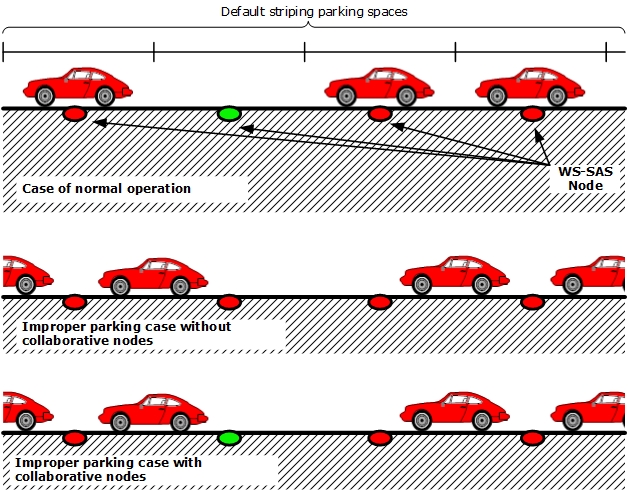
The system deploys a network of wireless electromagnetic sensors embedded in the pavement, which detect and monitor the entry and presence of the vehicle in the controlled places. The sensors are powered by battery and are placed in a bullet-proof, die-casting aluminum case which is semi-buried in the road and fixed by epoxy resin glue.
Any change to the status of the sensor is transmitted to a local gate (concentrator) working in 2.4-2.8 GHz. Each concentrator manages to up to 10 sensors placed at a distance of 100m max. Data are sent from the concentrator to the central data management server through GPRS, wifi or optical-fiber data network. In the central system all data concerning the use of the parking places are processed, organized, stored and displayed to the user.
The drivers are informed on the availability of free parking spaces via electronic message signs (VMS) placed in appropriately selected posts or through a specific mobile mapping application. Data management allows local government authorities or parking system managers to monitor in real time the availability and occupancy of parking places and having access to use data of all parking places.
The system is complemented by wired sensors (traffic cameras) placed at appropriate points of adjacent roads associated with the parking area. The cameras record and correlate the traffic flow with the use of respective parking places.
A free smart phone application, which uses GPS and mobile mapping technology, allows motorists to see nearby existing free parking spaces in real-time, reducing the time and energy spent searching for parking.
Benefits
The benefits expected from the development and operation of the City Parking Guide system includes:
- Improved ability to track road-side parking availability and use in large urban centers
- Support the rational use of parking spaces in urban areas by local government agencies
- Automated, reliable and real-time information to the drivers about the availability of parking places in the area that moves
- Reduction of emissions as a result of limiting unnecessary movements to find parking position
- More efficient use of road networks and parking spaces with updated availability and support guidance to approach free parking spaces and
- Contribution to the objective of creating smart and green cities